模拟启动时间和双台风对“21.7”河南极端暴雨事件的影响研究
Study on the impacts of simulation start time and binary typhoons on the "21.7" Henan extreme rainfall event
模拟启动时间和双台风对“21.7”河南极端暴雨事件的影响研究 |
| 张心怡, 张熠, 刘昊炎, 王其伟, 王迪 |
|
Study on the impacts of simulation start time and binary typhoons on the "21.7" Henan extreme rainfall event |
| Xinyi Zhang, Yi Zhang, Haoyan Liu, Qiwei Wang, Di Wang |
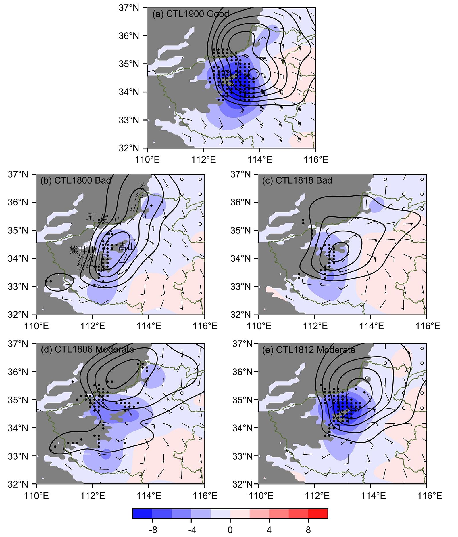
| 图5 2021年7月20日00时至21日00时24 h平均的950 hPa散度场(填色,单位:10-5 s-1)、200 hPa散度场(等值线,从4×10⁻⁵ s-1起始,每2×10⁻⁵ s-1递减)、24 h累积降水量超过200 mm的位置(点), (a)中风羽矢为CTL1900的950 hPa水平风场(全长对应4 m·s-1),(b~e)中风羽矢为CTL1900与各敏感试验950 hPa水平风场的差异 |
| Fig.5 24 h?averaged 950 hPa divergence field (shaded, unit: 10?? s?1), 200 hPa divergence field (contours starting at 4×10?? s?1 with intervals of 2×10?? s?1 decreasing), locations where 24 h accumulated precipitation over 200 mm (dots) from 00:00 UTC 20 July to 00:00 UTC 21 July 2021; The wind barbs in (a) represent the horizontal wind fields at 950 hPa for CTL1900 (full bar corresponds to 4 m·s-1), while the wind barbs in (b~e) represent the differences in the 950 hPa horizontal wind field between CTL1900 and each sensitivity experiment |
|
|